Sabo Check Dams: Mountain
protection systems in Japan
by Hubert CHANSON (h.chanson@uq.edu.au)
M.E., ENSHM Grenoble, INSTN, PhD (Cant.), DEng (Qld),
Eur.Ing., MIEAust., MIAHR, 13th
Arthur Ippen awardee
Dept. of Civil Engrg., Univ. of Queensland, Brisbane QLD
4072, Australia
 Introduction
In mountain areas, where debris torrents might have catastrophic and
dramatic impacts, "check dams" (also called debris dams or sabo dams) can
be used to reduce the impact of debris torrents. Debris dams are common
features in Europe, North America and Far East Asia. Illustrations are
shown in NAKAO (1993) and CHANSON
(2001).
The term "debris dam" is used to describe both consolidation dams and
sediment retention structures. The former is generally a wall-type
structure (e.g. Photo No. 1). It is
designed to elevate the torrent bed, to fix and to stabilise the bottom
profile. The latter type of structure is commonly an open structure (i.e.
grid dam, beam dam and split dam) designed for the trapping of medium- to
large-size debris (rocks, boulders, logs) (e.g. Photo
No. 2). ARMANINI et al. (1991)
described several examples of open structure check dams.
The dam construction decision process is a very important step in the
design. The choice of debris dam(s) building and their location must be
sound and optimal to prevent debris flow catastrophes.
Sabo works in Japan
The Japanese islands is characterised by a steep unstable topography with
frequent volcanic activities and earthquakes. Debris flows are frequent
and numerous disasters occurred. The original purpose of the sabo
structures was to reduce the excess sediment discharge to prevent river
degradation further downstream and to enable ship navigation in the
downstream streams. More recently the emphasis of Sabo works shifted to
the control of debris flows.
In Japanese, the direct translation of Sabo (sa-bo) is "sand
protection". Generally the term "sabo works" refers to mountain protection
system. Early sabo works were undertaken during the 17th and 18th
centuries. For example, a 10-m high masonry soil-retention structure in
Fukuyama (Hiroshima prefecture) is still standing. During the second half
of the 19th century and early 20th century, numerous sabo works were
constructed under the guidance of foreign engineers and of Japanese
engineers educated in Europe. For example, Dutch engineers were invited to
come to Japan in 1873, among which Johannis de RIJKE had a very
significant great influence. The Austrian engineer Hoffman designed sabo
works near the town of Seto, 20 km NE of Nagoya, in 1909. Photo
No. 31 shows an artificial stepped channel designed by a Japanese
engineer, modeled on Durance catchment works (construction : 1916-18) near
Matsumoto, Nagano Prefecture. The first concrete sabo check dam was
completed in 1916 : i.e., the Ashiyasu dam, Yamanashi Prefecture which is
still standing.
 A major debris structure is the 63-m high Shiraiwa Sabo dam (also
called Siraiwa dam). The main dam is equipped with a 12-step overflow
spillway (NAKAO 1993) and it is designed to trap
up to 1 Mm3 of sediment. Another large sabo structure is the Mount
Tokachidake Sabo works in the Furano river catchment. After completion,
the sabo system include 72 check dams, 11 slit dams and 71 consolidation
dams. The total cost was 0.8 Billion of yens in 1993. An interesting
example of sabo works system is the Kakurajima Volcano Sabo works. The
Kakurajima island is 12 km wide by 19 km long. The volcano is active and
large scale volcano eruption took place in 1471-1476, 1779-1785, 1914 and
1946. All 18 rivers are equipped with Sabo works and debris flow occurred
each year. During debris runoff, the velocity of debris flow were observed
to reach 40 to 70 km/h (NAKAO 1993).
A major debris structure is the 63-m high Shiraiwa Sabo dam (also
called Siraiwa dam). The main dam is equipped with a 12-step overflow
spillway (NAKAO 1993) and it is designed to trap
up to 1 Mm3 of sediment. Another large sabo structure is the Mount
Tokachidake Sabo works in the Furano river catchment. After completion,
the sabo system include 72 check dams, 11 slit dams and 71 consolidation
dams. The total cost was 0.8 Billion of yens in 1993. An interesting
example of sabo works system is the Kakurajima Volcano Sabo works. The
Kakurajima island is 12 km wide by 19 km long. The volcano is active and
large scale volcano eruption took place in 1471-1476, 1779-1785, 1914 and
1946. All 18 rivers are equipped with Sabo works and debris flow occurred
each year. During debris runoff, the velocity of debris flow were observed
to reach 40 to 70 km/h (NAKAO 1993).
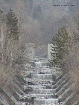
Sabo check dams
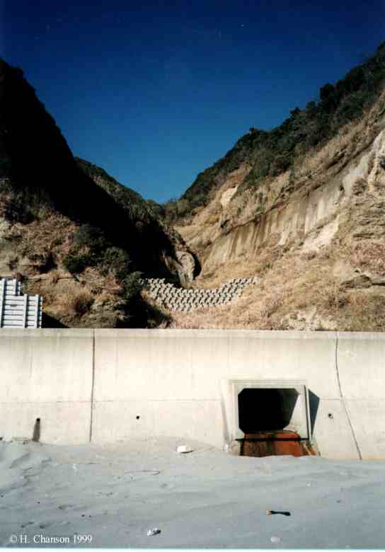
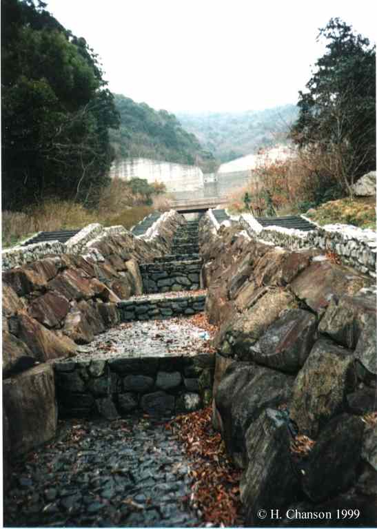
The most common type of sabo dams is the vertical concrete wall (e.g. Photo No. 6, Photo
No. 7, Photo No. 10, Photo
No.
34,). The structure has the initial purpose to trap sediment
material (Photo No. 18) and to reduced
the slope of the upstream catchment when the reservoir is filled (Photo
No. 35). The downstream face of the dam is nearly vertical, followed
by a short stilling structure. In steep topography, the downstream channel
may be stepped to contribute to further energy dissipation, in a fashion
somehow similar to stepped spillways (Photo
No.
6, Photo No. 19) (1).
Dam heights range from 3 to 15 m typically.
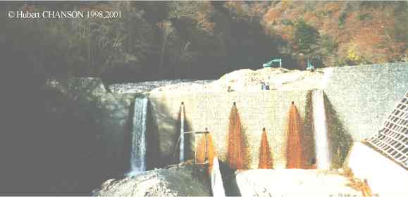
Other types of sabo check dams include permeable check dams, tubular grid
dams, slit dams and overflow stepped weirs. Permeable check dams are
designed to trap small to medium size debris. They do not hold water. In
forest areas, permeable dam may be made of steel grids. Figure
8 shows a permeable structure near Matsumoto, Nagano
prefecture. Others may be made of concrete elements commonly used
for coastal protection. Photo No. 2
shows a permeable Sabo work off Takatoyo beach, Enshu coast while Photo
No. 23 presents debris material and concrete blocks on the
Osawa-gawa, Western slope of Mount Fuji.
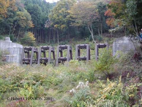 Tubular grid dams
are made of large-size steel tubes (diameters between 0.5 to 1 m) anchored
in reinforced concrete foundations. They are designed to hold heavy
sediment blocks (e.g. boulders, huge rocks) weighting over 10 tons. Figure
15 shows a tubular grid structure, 9 m high, 60 m long. The steel
tubular elements are 7 m high and the tube diameter is 0.7 m. The design
technique was developed in the late 1960s, but it became more common since
the late 1980s.
Tubular grid dams
are made of large-size steel tubes (diameters between 0.5 to 1 m) anchored
in reinforced concrete foundations. They are designed to hold heavy
sediment blocks (e.g. boulders, huge rocks) weighting over 10 tons. Figure
15 shows a tubular grid structure, 9 m high, 60 m long. The steel
tubular elements are 7 m high and the tube diameter is 0.7 m. The design
technique was developed in the late 1960s, but it became more common since
the late 1980s.
Slit check dams are a form of permeable debris dams for medium-size
debris. They are designed with one or several vertical opening(s) to allow
small to medium flow while large flow will overtop the structure. Photo
No. 4 shows the Inokubo-kawa Kikan Sabo system (Mt Fuji, Japan). The
Inokubo stream is located on the Western slope of Mt Fuji, close to
Osawa-gawa and Urui river. A major debris retention system, called
Inokubo-kawa Kikan, was in construction in Nov. 2001. The system includes
a flat, wide flood plain area to store large material and a slit check dam
downstream. ARMANINI and LARCHER (2001)
presented recently a detailed model study of slit check dams (single
opening).
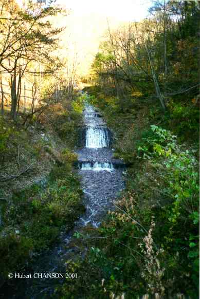
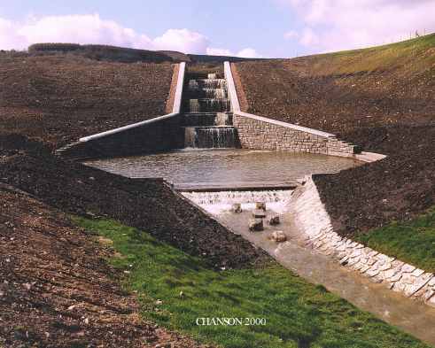
Another form of check dams is the series of overflow stepped weirs. Each
structure is about 1 to 4 m high. Stepped overflow weirs are designed to
reduce the upstream slope while the steps contribute to some energy
dissipation of the overflow at small to medium flow rates. For large
flows, the weir acts as a large roughness element. Examples include Photo
No. 9 near Mitomi town, Yamanashi prefecture and Photo
No. 43
in Wales (UK).
Discussion
During a debris flow motion, what controls the height and propagation
speed of the wall of mud ? If the river bed is initially dry, the problem
is the classical dam brek wave (on dry bed). This has been developed
thouroughly in several textbooks for clear-water (HENDERSON
1966, MONTES 1998,
CHANSON 2004a,b). If the river bed is filled
with water, the leading edge of the surging waters becomes a positive
surge (i.e. a hydraulic jump in translation). The problem is drastically
different from the dam break wave on dry bed. (See for example, HENDERSON
1966, MONTES 1998, CHANSON
2004a,b for a thourough treatment.)
The propagation of a mud flow is however a more complicated problem in
real situations, particularly steep catchments, when sediment-laden flows
may exhibit some non-Newtonian properties. Relevant references include WAN and WANG (1994), COUSSOT
(1997) and CHANSON et al. (2006). Recent
studies demonstrated completely opposite trends depending upon the initial
fluid properties (i.e. rheological properties of the mud). CHANSON et al.
(2004) developed a kinematic wave approximation of the Saint-Venant
equations for a thixotropic fluid flow down a prismatic sloping channel. A
simple thixotropic fluid model was used which is based upon a minimum
number of parameters, and described the instantaneous state of fluid
structure by a single parameter. Analytical solutions of the basic flow
motion and rheology equations predicted three basic flow regimes depending
upon the fluid properties and flow conditions, including the initial
degree of jamming of the fluid : (1) a short motion with relatively-rapid
flow stoppage for relatively small mass of fluid, (2) a fast flow motion
for a large mass of fluid, or (3) an intermediate motion initially rapid
before final fluid stoppage for intermediate fluid properties. This
behaviour, unknown to turbulent or laminar fluid motion, is typical of
well-known thixotropic fluid flows, such as pasty cement flows, some mud
flows, and subaerial or submarine landslides. It was validated with
physical experiments investigating systematically dam break wave of
thixotropic fluid down a 15-deg channel (CHANSON et
al. 2004).
 Footnotes
(1) There is however a major difference
in cross-sectional shape. Most stepped spillways are designed with a
prismatic rectangular cross-section while stepped waterways may have
trapezoidal shapes, sometimes with side floodplains (e.g. Photo
No.
6).
Detailed
photographs
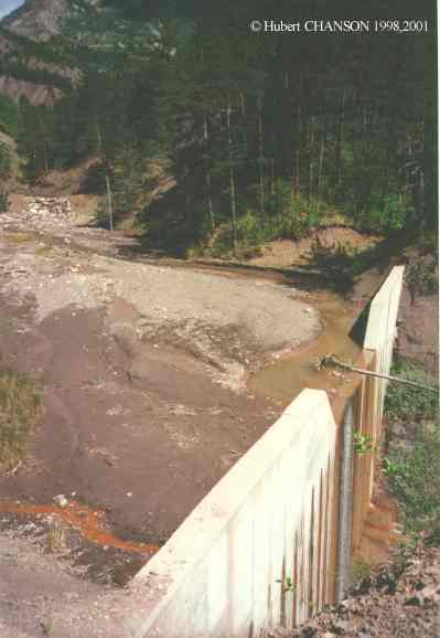
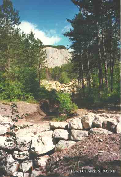
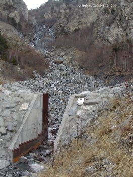
Photo No. 1 : Sabo works, in the Hayagawa
catchment (Fujigawa catchment, Japan) in November 1998.
Photo No. 2 : Permeable Sabo work off
Takatoyo beach, Enshu coast (Japan) on 30 January 1999.
Photo No. 3 : Debris material in Osawa
creek (Mt Fuji, Japan) on 1 Nov. 2001. Note the concrete blocks and
excavators working behind to remove debris.The Osawa creek is located
beneath the main fault on the western
side of Mount Fuji. (Mount Fuji
last erupted in 1707.) Major debris flows took place in summer 2000.
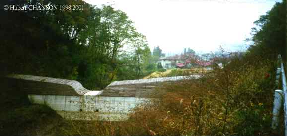
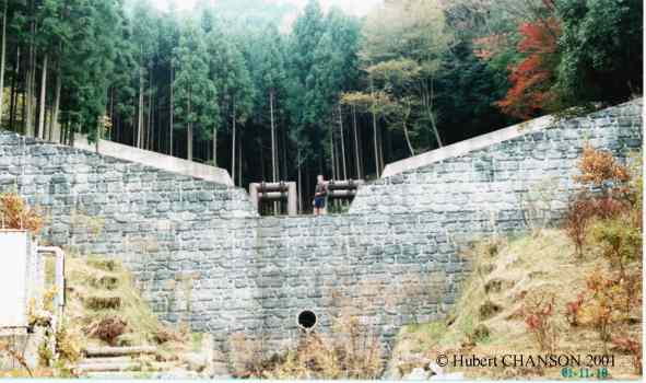
Photo No. 4 & 5 : Inokubo-kawa Kikan
Sabo system (Mt Fuji, Japan). The Inokubo stream is located on the Western
slope of Mt Fuji, close to Osawa-gawa and Urui river. A major debris
retention system, called Inokubo-kawa Kikan, was in construction in Nov.
2001. The system includes a flat, wide flood plain area to store large
material and a slit check dam downstream. The slit
check dam is 104 m wide and 7 m high. View
from the right bank on 1 Nov. 2001.
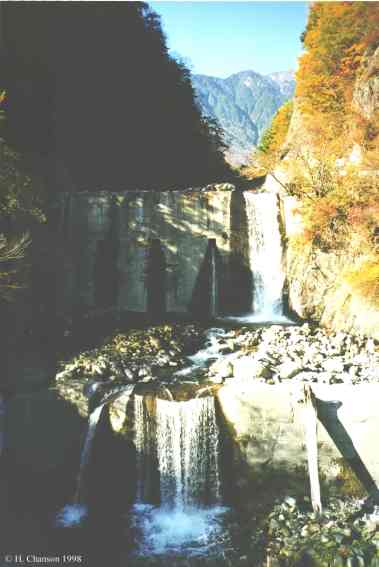
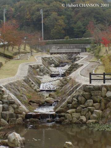
Photo No. 6 : Sabo dam (H=12.5m, L=117m)
and stepped storm waterway (1992, Toyohashi, Aichi prefecture, Japan). The
sabo system was built to protect the Sekiganji temple and a kindergarden,
both located downstream. The footpaths on each side of the stepped waterway
were designed to act as flood plains during extreme events. Photograph in
March 1999.
Photo No. 7 & 8 : Sabo check dams
above Matsumoto, Nagano Prefecture. Photographs taken in Nov. 1998. Modern
concrete (timber facing) structure above the town. Older steel
permeable sabo check dam located upstream of the first structure.
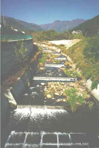
Photo No. 9 & 10 : Sabo works near Mitomi town, Yamanashi
prefecture. Photographs taken in Nov. 1998. Stepped
river training. Medium-size sabo
check dam on the left slope of Nishizawa-keikoku river.
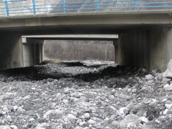
Photo No. 11 : Sabo works downstream of
a road bridge on Kagokawa river (Nov. 1998).
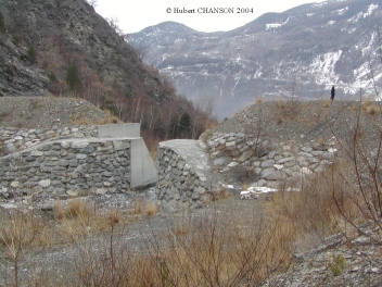
Photo No. 12, 13 & 14 : Combination
of an upstream tubular grid check dam
(H = 9 m, L = 55 m, 2 elements) with a downstream concrete
check dam (H = 7 m, L = 52 m) in the Hiakari-gawa catchment, Toyota,
Aichi prefecture. Photo No. 14 shows
details of a steel tubular element. Photographs taken on 10 Nov. 2001.
Photo No. 15, 16 & 17 : Tubular
grid check dam (H = 9 m, L = 60 m, 5 elements) located upstream of
concrete check dam (H = 6 m, L = 53 m) in the Hiakari-gawa catchment,
Toyota, Aichi prefecture. View from the
left abutment. The concrete check dam is followed by a stepped waterway in
the middle of camping grounds (Photo No. 17).
Photographs taken on 10 Nov. 2001.
Photo No. 18 & 19 : Empty check
dam East of Okazaki city, Aichi prefecture. Downstream, the stream is
channelised in a stepped waterway in the
middle of a residential area. Photographs taken on 10 Nov. 2001.
Photo No. 20 & 21 : Old check dam
that has fullfilled its role near Tahara, Irago peninsula, Aichi prefecture.
Downstream stepped waterway in the
middle of sporting grounds. Photographs taken on 11 Nov. 2001.
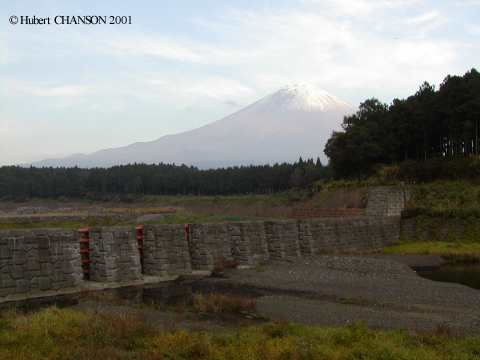
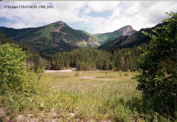
Photo No. 22, 23, 24 & 25 : Mount Fuji Sabo works on the
Osawa-gawa. The Osawa creek is located beneath the main fault on the western
side of Mount Fuji. (Mount Fuji
last erupted in 1707.) Major debris flows took place in summer 2000. Photo
No. 22 : debris material region on Osawa-gawa on 1 Nov. 2001. Photo
No. 23 : debris material on 1 Nov. 2001, note the concrete blocks and
excavators working behind to remove debris. Photo
No. 24 : exploded concrete "tetrapod" block (1 Nov. 2001). Photo
No. 25 : concrete river training downstream of the debris flow region.
Photo No. 26 & 27- Sabo
works and check dams in Jogangi River catchment, Japan. Located South of
Toyama City, the river catchment is very steep and affected by massive
sediment motion processes. Photo No. 26
: Sabo works on the Jogangi River immediately downstream of a series of
train and road bridges on 12 Nov. 2008; note the train passing the bridge. Photo No. 27 : Sabo works on a tributary
of Jogangi River on 12 Nov. 2008; the photograph was taken upstream of Photo
No. 26.
Early sabo works
Photo No. 31 : Ancient Sabo works
(1895-1920) near Matsumoto, Nagano Prefecture. Artificial
stepped channel designed by a Japanese engineer, modeled on Durance
catchment works (construction : 1916-18). Photograph taken in Nov. 1998.
Related designs in the world
Photo No. 41 : Stepped storm water way
(Hong Kong) under Hatton road, below Hong Kong University (photograph in
Sept. 1994).
Photo No. 42 : Loyalty Road Flood
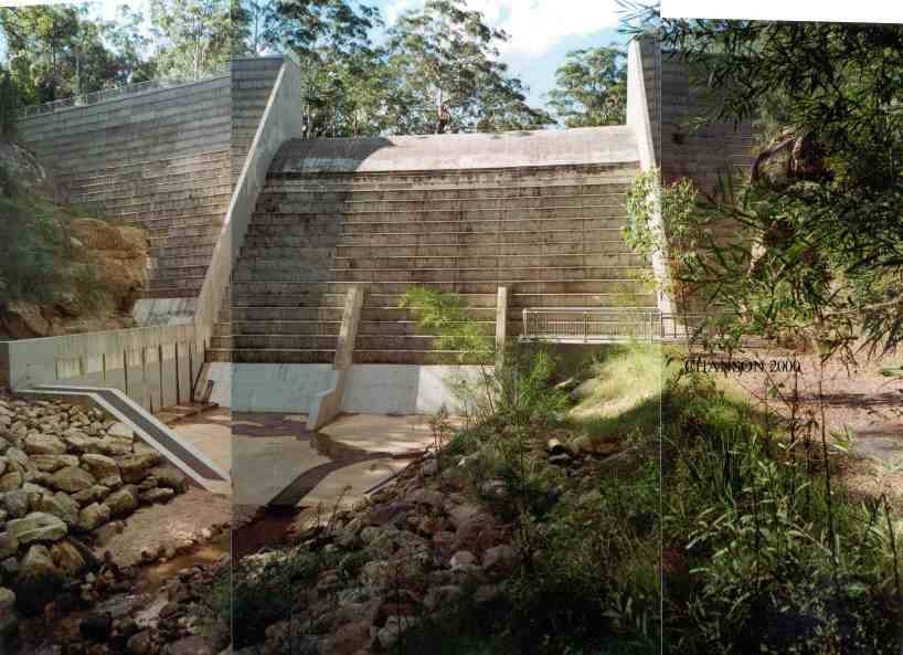
Retarding dam spillway (Sydney NSW, Australia, 1996) View from downstream
(Courtesy of D.Patrick JAMES). Dam height : 30 m. RCC construction.
Spillway capacity : 1,040 m3/s. Chute width : 30 m.
Photo No. 43 : Rhyd-y-Car Land
Reclamation cascade (Wales). Design flow : 10 m3/s. Located at Merthyr
Tydfil town centre (approx. 50 km North of Cardiff, UK) (Courtesy of Steve
BRIGHT).
Photo No. 44 & 45 : La Motte-du-Caire, Durance catchment
(France). Photographs taken in June 1998. Debris
dams on the road to La Motte-du-Caire. Concrete
check dam upstream of the fully-silted Saignon dam, La
Motte-du-Caire (CHANSON 1999). The Saignon
dam reservoir (1961, H=17 m, volum:1.8E+5 m3) became fully-silted in
less than 2 years despite upstream check dams (Photo
No. 45). View from the right
bank of the dam, looking upstream. The reservoir is located in a black
marl catchment (3.5 km2 area).
Photo 46 & 47 : Check dams and river training, Ruisseau Ravin de St
Julien, St-Julien-Mont-Denis (France). Photo
No. 1 : river training in St-Julien-Mont-Denis on 11/2/2004; note
the slit check dam in background. Photo
No. 2 : slit check dam looking downstream.
Photo 48 : Check dam and sediment retention basin, Ruisseau St Bernard,
Saint-Martin-de-la-Porte (France). Photo
No 1: looking upstream on 11/2/04.
Photo 49 : Sediment load in an
artificial channel beneath the Autoroute de Maurienne, France on
11/2/2004.
Related
links
 References
ARMANINI, A., and LARCHER, M. (2001). "Rational criterion for designing
opening of slit-check dam." Jl of Hyd. Engrg., ASCE, Vol. 127, No.
2, pp. 94-104.
ARMANINI, A., DELLAGIACOMA, F., and FERRARI, L. (1991). "From the Check Dam
to the Development of Functional Check Dams." Intl Work. Fluvial
Hydraulics of Mountain Regions, IAHR, Springer Verlag, Berlin,
Germany, ARMININI and DI DILVIO Ed., pp. 331-344.
CHANSON, H. (1999). "The Hydraulics of Open
Channel Flows : An Introduction." Butterworth-Heinemann,
Oxford, UK, 512 pages (ISBN 0 340 74067 1). (Reprinted in 2001)
CHANSON, H. (2001). "The Hydraulics of Stepped
Chutes and Spillways." Balkema, Lisse, The Netherlands (ISBN
90 5809 352 2).
CHANSON, H. (2004). "Environmental
Hydraulics of Open Channel Flows." Butterworth-Heinemann,
Oxford, UK (ISBN 0 7506 6165 8).
CHANSON, H. (2004). "The
Hydraulics of Open Channel Flows : An Introduction." Butterworth-Heinemann, 2nd edition, Oxford,
UK (ISBN 0 7506 5978 5).
CHANSON, H., JARNY, S., and COUSSOT, P. (2006). "Dam Break Wave of
Thixotropic Fluid." Journal of Hydraulic Engineering, ASCE, Vol.
132, No. 3, pp. 280-293 (doi:10.1061/(ASCE)0733-9429(2006)132:3(280))
(ISSN 0733-9429). (PDF
file at UQeSpace)
NAKAO, T. (1993). "Research and Practice of Hydraulic Engineering in Japan -
Sabo (Erosion Control)." Jl of Hydroscience and Hyd. Eng. in Japan,
No. SI-4 River Engineering, pp. 175-229.
Bibliography
CHANSON, H. (2004). "Sabo Check Dams - Mountain Protection Systems in
Japan." Jl River Basin & Manag.,
Vol. 2, No. 4, pp. 301-307 (ISSN 1571-5124). (PDF
file at EprintsUQ)
CHANSON, H., COUSSOT, P., JARNY, S., and TOQUER, L. (2004). "A Study
of Dam Break Wave of Thixotropic Fluid: Bentonite Surges down an Inclined
plane." Report No. CH54/04, Dept.
of Civil Engineering, The University of Queensland, Brisbane, Australia,
June, 90 pages (ISBN 1864997710). (Download
http://www.uq.edu.au/~e2hchans/reprints/ch5404.zip
[2.1 Mb]) (PDF
version at EprintsUQ) Order Hard Copy
COUSSOT, P. (1997). "Mudflow Rheology and Dynamics." IAHR
Monograph, Balkema, The Netherlands.
COUSSOT, P., ROUSSEL, N., JARNY, S., and CHANSON, H. (2005).
"Continuous or Catastrophic Solid-Liquid Transition in Jammed Systems." Physics of Fluids, Vol. 17, No. 1,
Article 011703, 4 pages (ISSN 0031-9171). (PDF
file at UQeSpace) (Download PDF
file)
HENDERSON, F.M. (1966). "Open Channel Flow." MacMillan
Company, New York, USA.
HUNT, B. (1984). "Perturbation Solution for Dam Break Floods." Jl of Hyd. Engrg., ASCE, Vol. 110, No.
8, pp. 1058-1071.
HUANG, X., and GARCIA, M. (1998). "A Herschel-Bulkley Model for Mud
Flow Down a Slope." Jl of Fluid Mech.,
Vo. 374, pp. 305-333.
HUNT, B. (1994). "Newtonian Fluid Mechanics Treatment of Debris Flows
and Avalanches." Jl of Hyd. Engrg.,
ASCE, Vol. 120, No. 12, pp. 1350-1363.
MONTES, J.S. (1998). "Hydraulics of Open Channel Flow." ASCE
Press, New-York, USA, 697 pages.
ROUSSEL, N., LE ROY, R., and COUSSOT, P. (2004). "Thixotropy
Modelling at Local and Macroscopic Scales." Jl
of
Non-Newtonian Fluid Mech., Vol. 117, No. 2-3, pp. 85-95.
TAKAHASHI, T. (1991). "Debris Flow." IAHR
Monograph, Balkema Publ., Rotterdam, The Netherlands.
WAN, Zhaohui, and WANG, Zhaoyin (1994). "Hyperconcentrated Flow." Balkema, IAHR Monograph, Rotterdam, The
Netherlands, 290 pages.
WILSON, S.D.R., and BURGESS, S.L. (1998). "The Steady, Speading Flow
of a Rivulat of Mud." Jl Non-Newtonian
Fluid Mech., Vol. 79, pp. 77-85.
Video movies at UQeSpace
CHANSON, H. (2020). "Hydraulics of open channel flow: practical
experiments at the University of Queensland, Australia." Collection, Generic
Document, The University of Queensland, School of Civil Engineering,
Brisbane, Australia (ISBN 978-1-74272-311-2). {https://espace.library.uq.edu.au/collection/UQ:734960}
EDLIN, S., LU, Z., and CHANSON, H. (2020). "The
Broad-Crested Weir." Generic Document, The University of Queensland, School
of Civil Engineering, Brisbane, Australia (ISBN 978-1-74272-311-2). {https://espace.library.uq.edu.au/view/UQ:734961}
SHI, S., ASTORGA MOAR, A., and CHANSON, H. (2020). "The
Hydraulic Jump." Generic Document, The University of Queensland, School of
Civil Engineering, Brisbane, Australia (ISBN 978-1-74272-311-2). {https://espace.library.uq.edu.au/view/UQ:734962}
LI, Y., LANCASTER, O., and CHANSON, H. (2020). "Backwater
in a Long Channel." Generic Document, The University of Queensland, School
of Civil Engineering, Brisbane, Australia (ISBN 978-1-74272-311-2). {https://espace.library.uq.edu.au/view/UQ:734963}
WUTHRICH, D., WUPPUKONDUR, A., and CHANSON, H. (2020).
"Hydraulics of Culverts." Generic Document, The University of Queensland,
School of Civil Engineering, Brisbane, Australia (ISBN 978-1-74272-311-2). {https://espace.library.uq.edu.au/view/UQ:734964}
Acknowledgments
The writer thanks Dr Y. YASUDA, Professor I. OHTSU and Dr S. AOKI for their
advice and assistance. He thanks also Y.H. CHOU and B. CHANSON for their
support.
Hubert
CHANSON is a Professor in Civil Engineering, Hydraulic Engineering
and Environmental Fluid Mechanics at the University
of Queensland, Australia. His research interests include design of
hydraulic structures, experimental investigations of two-phase flows,
applied hydrodynamics, hydraulic engineering, water quality modelling,
environmental fluid mechanics, estuarine processes and natural resources.
He has been an active consultant for both governmental agencies and
private organisations. His publication record includes over 950
international refereed papers and his work was cited over 5,000 times
(WoS) to 19,500 times (Google
Scholar) since 1990. His h-index is 40 (WoS), 44 (Scopus) and 70 (Google
Scholar), and he is ranked among the 150 most cited researchers in
civil engineering in Shanghais
Global Ranking of Academics. Hubert Chanson is the author of twenty
books, including "Hydraulic Design
of Stepped Cascades, Channels, Weirs and Spillways" (Pergamon,
1995), "Air Bubble Entrainment in
Free-Surface Turbulent Shear Flows" (Academic
Press, 1997), "The Hydraulics
of Open Channel Flow : An Introduction" (Butterworth-Heinemann,
1st edition 1999, 2nd
editon 2004), "The Hydraulics of
Stepped Chutes and Spillways" (Balkema,
2001), "Environmental
Hydraulics of Open Channel Flows" (Butterworth-Heinemann,
2004), "Tidal
Bores, Aegir, Eagre, Mascaret, Pororoca: Theory And Observations" (World
Scientific, 2011) and "Applied
Hydrodynamics:
an Introduction" (CRC
Press, 2014). He co-authored two further books "Fluid Mechanics for
Ecologists" (IPC Press, 2002) and "Fluid Mechanics for Ecologists.
Student Edition" (IPC, 2006). His
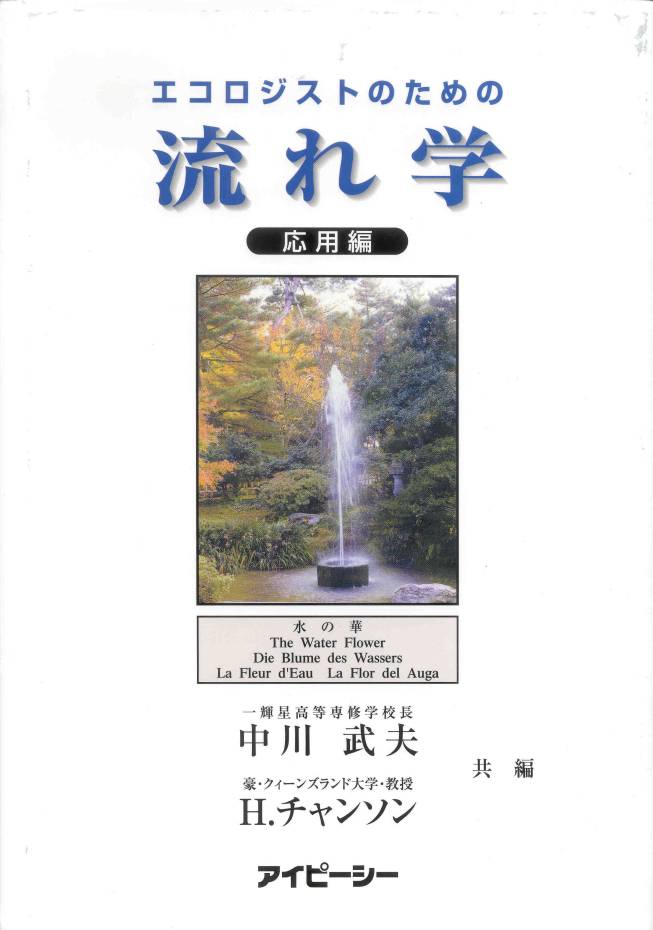
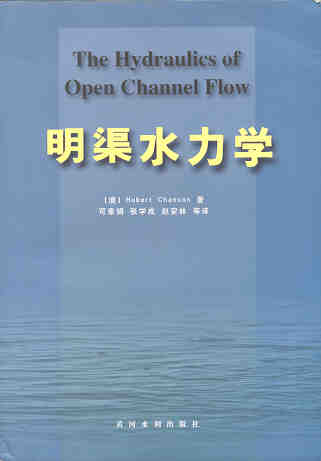
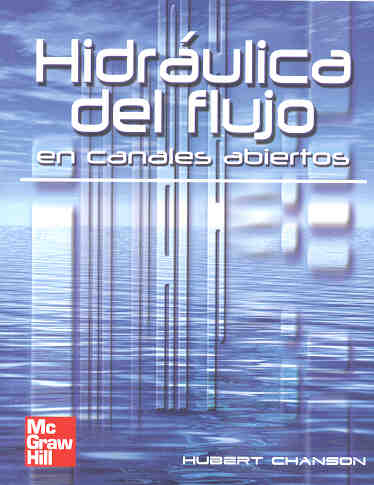
textbook "The Hydraulics of Open Channel Flows : An Introduction" has
already been translated into Spanish (McGraw-Hill
Interamericana) and Chinese (Hydrology Bureau of Yellow
River Conservancy Committee), and the second
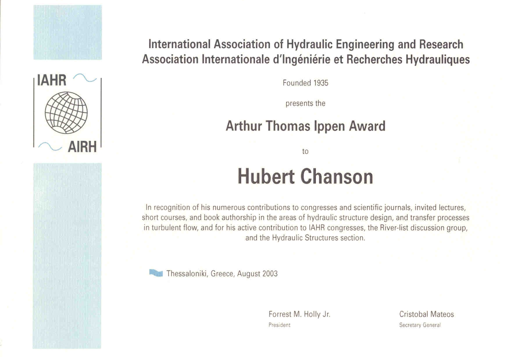
edition was published in 2004. In 2003, the IAHR
presented him with the 13th Arthur Ippen Award
for outstanding achievements in hydraulic engineering. The American
Society of Civil Engineers, Environmental and Water Resources Institute
(ASCE-EWRI) presented him with the 2004 award for the Best Practice paper
in the Journal of Irrigation and Drainage Engineering ("Energy
Dissipation
and Air Entrainment in Stepped Storm Waterway" by Chanson and
Toombes 2002) and the 2018 Honorable Mention Paper Award for "Minimum Specific
Energy and Transcritical Flow in Unsteady Open-Channel Flow" by
Castro-Orgaz and Chanson (2016) in the ASCE Journal of Irrigation and
Drainage Engineering. The Institution of Civil Engineers (UK) presented
him the 2018 Baker Medal. In 2018, he was inducted a Fellow of the Australasian Fluid Mechanics Society.
Hubert Chanson edited further several books : "Fluvial,
Environmental and Coastal Developments in Hydraulic Engineering"
(Mossa, Yasuda & Chanson 2004, Balkema),
"Hydraulics.
The
Next Wave" (Chanson & Macintosh 2004, Engineers
Australia), "Hydraulic
Structures:
a Challenge to Engineers and Researchers" (Matos & Chanson 2006,
The University of Queensland), "Experiences and
Challenges in Sewers: Measurements and Hydrodynamics" (Larrate &
Chanson 2008, The University of
Queensland), "Hydraulic
Structures:
Useful Water Harvesting Systems or Relics?" (Janssen & Chanson
2010, The University of Queensland),
"Balance
and Uncertainty: Water in a Changing World" (Valentine et al. 2011,
Engineers Australia), "Hydraulic
Structures and Society Engineering Challenges and Extremes"
(Chanson and Toombes 2014, University
of Queensland), "Energy
Dissipation
in Hydraulic Structures" (Chanson 2015, IAHR
Monograph, CRC Press). He chaired the Organisation of the 34th
IAHR World Congress held in Brisbane, Australia between 26 June and
1 July 2011. He chaired the Scientific Committee of the 5th IAHR
International Symposium on Hydraulic Structures held in Brisbane in
June 2014. He chairs the Organisation of the 22nd Australasian Fluid
Mechanics Conference in Brisbane, Australia on 6-10 December 2020.
His Internet home page is http://www.uq.edu.au/~e2hchans.
He also developed a gallery of photographs website {http://www.uq.edu.au/~e2hchans/photo.html}
that received more than 2,000 hits per month since inception.
More pictures of sabo check dams are HERE
...
TECHNICAL INTERNET RESOURCES
More about a history of arch dams
... More about timber crib
weirs ... More about steel
dams ...
More about engineering
failures ... More about rubber
dams ... More about a tidal
bore ...
More about the Formal Water Garden
.... More about rapid
reservoir sedimentation in Australia ...
More about Minimum Energy Loss culverts
.. More about Minimum Energy
Loss weirs ...
This page was visited : 7,989 times between
09-11-2001 and June 2012.
Last updated on 31/3/2013


